Explore over 500,000 Images in my personal collection

|
|
- Code Number:
- UPDD01_006
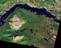
- Title:
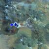
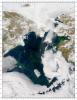
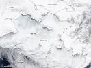
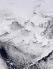
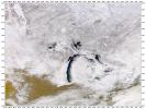
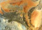
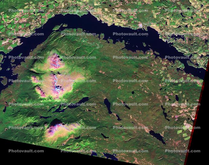
- Pine Beetle Infestation in British Columbia
- Pine beetles and conifer forests have long coexisted in British Columbia. Around the turn of the twenty-first century, a combination of factors, including fire suppression and mild winters, allowed beetles to destroy unusually large tracts of forest. So many trees have sickened and died that the damage is visible in satellite imagery.
The Advanced Spaceborne Thermal Emission and Reflection Radiometer (ASTER) on NASA?s Terra satellite observed part of British Columbia on October 8, 2006. This image is made from a combination of light visible to human eyes and light our eyes cannot see (near- and shortwave infrared). Similar to a true-color image, deep blue indicates water and green indicates vegetation. While bright green indicates healthy vegetation, damaged forest appears in pink-tinged hues. Cleared land (logged or naturally bare) appears pinkish brown.
NASA image created by Robert Simmon, using data from NASA/GSFC/METI/ERSDAC/JAROS, and the U.S./Japan ASTER Science Team. Caption by Michon Scott. Instrument: Terra - ASTER - Keywords:
- Image by:
- NASA
- Caption Disclaimer