Explore over 500,000 Images in my personal collection
real images | real history | no AI

|
|
- Code Number:
- UPDD01_005
- Title:
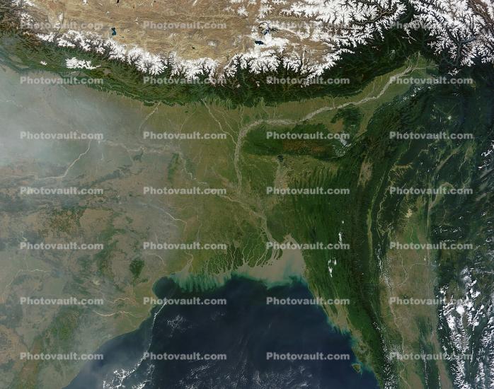
- Himalayas, Bangladesh, Ganges River, India, China, Climate Change, Bay of Bengal
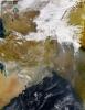
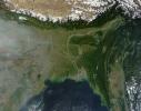
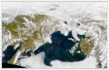
- A relatively small country along the Bay of Bengal, Bangladesh is nearly surrounded by India and has been shaped by it. Between 40 and 50 million years ago, India collided with Eurasia, elevating the Himalaya. Eroded by wind and water, the newly uplifted land shed sediments, which now cover almost all of Bangladesh. Tectonic activity also deformed rock layers in eastern Bangladesh.
On November 9, 2011, clear skies allowed the Moderate Resolution Imaging Spectroradiometer (MODIS) on NASA?s Terra satellite an unobstructed view of Bangladesh. This natural-color image shows all of that country, as well as parts of India, Burma (Myanmar), and the Bay of Bengal. Included in the scene are the Sundarbans of the Ganges-Brahmaputra Delta.
NASA image courtesy Jeff Schmaltz, LANCE/EOSDIS MODIS Rapid Response Team at NASA GSFC. Caption by Michon Scott. Instrument: Terra - MODIS - Keywords:
- Image by:
- NASA
- Caption Disclaimer
Royalty Free: Calculate Price