Explore over 500,000 Images in my personal collection

|
|
- Code Number:
- UPDD01_015
- Title:
- Colorado River
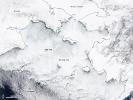
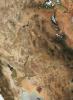
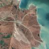
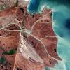
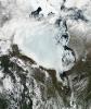
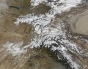
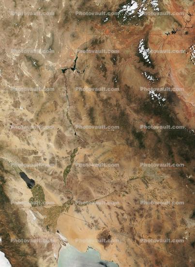
- This Moderate-resolution Imaging Spectroradiometer (MODIS) true-color image shows the passage of the Colorado River through several southwestern states. The river begins, in this image, in Utah at the far upper right, where Lake Powell is visible as dark pixels surrounded by the salmon-colored rocks of the Colorado Plateau. The Colorado flows southwest through Glen Canyon, to the Glen Canyon Dam, on the Utah-Arizona border. From there it flows south into the Arizona desert, and then turns sharply west where the Grand Canyon of the Colorado cuts through the mountains. The Colorado flows west to the Arizona-Nevada (upper left) border, where it is dammed again, this time by thes:" Hoover Dam". The dark-colored pixels surrounding the bend in the river are Lake Mead. The river flows south along the border of first Nevada and Arizona and then California and Arizona. The Colorado River, which begins in Rocky Mountain National Park in Colorado, empties into the Gulf of California Mexico, seen at the bottom center of this image.
Image courtesy Jacques Descloitres, MODIS Land Rapid Response Tea - Keywords:
- Image by:
- NASA
- Caption Disclaimer