Explore over 500,000 Images in my personal collection
real images | real history | no AI

|
|
- Code Number:
- TPHV01P05_10
- Title:
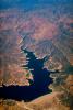
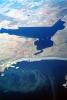
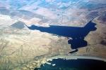
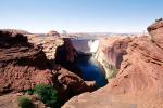
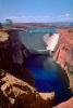
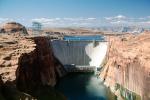
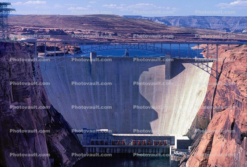
- Lake Powell, Glen Canyon Dam, Page, Arizona, USA
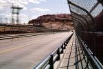
- This steel arch bridge spans 475.5 meters (1,560 feet) and rises 213 mters (700 feet) above the Colorado River. It is the 4th highest bridge in the USA. Behind this Glen Canyon dam is the artificial lake it created Lake Powell. This project has inundated a huge swath of spectacular Arizona nature including Glen Canyon. US Highway 89 is carried at the top of the dam.
Height (foundation) 220 meters, (710 feet)
Length 480 meters (1,560 feet)
Elevation at crest 1,132 meters (3,715 feet)
Spillway type: Tunnel, gated
Spillway capacity: 208,000 cu ft/s (5,900 m3/s)
Total capacity: 27,000,000 acre?ft (33 km3)
Catchment area: 108,335 sq mi (280,590 km2)
Surface area: 161,390 acres (65,310 ha)
Turbines: 8x 254,000 hp, 116 MW, Francis turbines
Installed capacity: 1,320 MW
Annual generation: 4,217 GWh
Maintained by: Bureau of Reclamation - Keywords:
- Image by:
- Wernher Krutein
- Caption Disclaimer
Royalty Free: Calculate Price