Explore over 500,000 Images in my personal collection
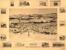
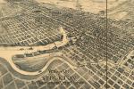
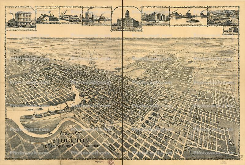
|
Stockton aerial map, 1890's
|
 
Code Number:
CNCD03_263
Title:
Stockton aerial map, 1890's
Keywords:
Northern California, Structure, Archives, History, Historical, Architecture

Buy Print:

Lakeport, Lake County, MapLakeport, Lake County, MapLakeport, Lake County, buildingsStockton aerial map, 1890'sStockton aerial map, 1890'sStockton landmark buildings, 1890'sWhiskeytown National Recreation Area in Shasta Countyreservoir, Whiskeytown National Recreation Areaearly morning fog begins its slow retreat, PaintographySonoma County Coast, coastline, shoreline, waves rocks, cliffs, waves, PaintographyEagle Statue, female figures, roadsideWhere the River meets the Ocean, JennerWhere the River meets the Ocean, Jennermy little garden
Previous Page Next Page
Go to lightbox