Register
Sign In
Username:
Password:
remember my username on my computer
Forgot your password?
Sign In
PhotoPoints
|
Lightboxes
View cart
Stewardship
Help
Wernher Krutein's
Photovault.
®
com
Explore over 500,000 Images in my personal collection
Escape advanced search
How to use
Search only for
Royalty free
Rights Managed
Horizontal
Vertical
Panorama
Foto object
Editorial
Released
Aerial
Hi-resolution
Silhouette
Painting
All Photographers
Allesandro Palldini
Andreas Koutsourelis
Andy Thielen
Andy Thielen
Antonio Tovar
Arline K. Cawley
Arthur Contos
Assaf Resnick
Bill Chase
Bill Clark
Bill Goidell
Bill Heick
Bob Gardner
Brian Broom
Burt Lawson
Caitlin Manning
Charles Hemphill
Charles Rotter
Chris Richardson
Dale Woodyard
Dave Vasquez
David Bassano
David Becker
Dawn Lederer
Dean Davis
Dick Neville
Don Carroll
Doug Workmaster
Duncan Edwards
Ed Vasgersian
Edmund Chase Shaw
Einily Zoe Eisenberg
Elaine Abrams
Elizabeth Turhal
Felbinger
Gabe Morford
Garrett Culhane
George H. Ulrich Jr.
Gordon Tan
Guerdon Trueblood
Henry Bettman
Hillary Goidell
Horst Fulle
Igor Stalew
Ila Peterson
J. Reed
Jack Kilpatrick
Jeremiah Pick
Jim Keen
Jim Sunberg
Jim Warhol
Jonathan Stoller
Jonathon Eros
Jordan
Joseph Mooney
Josh Cezan
Josh Dick
Jym Warhol
K. Lyle Moore
Kathleen Chute
Kelly Gavin
Kenny Blakey
Kevin Kholer
Kevin Wu
Khalila Wolfe
Kristina Grace
Lalo Obregon
Lara Justice
Larry Nattras
Lee Celano
Les Clark
Lexine Alpert
Lilith Rogers
Lisa Kristine
Manfred Krutein
Marc Drummond
Marcus Ward
Marios Koutsourelis
Mark Burstein
Mark Downey
Mark Leialoha
Mark Weissman
Martin Higgins
Mary Covell
Max Perez
Michael Robataille
Miercea Bumbesti
Mircea Bumbesti
Nancy Wu
NASA
Neal Katz
Nikola Zirganos
Nikolas de Rohan
Noriko Iizuka
Pauline Jacobson
Peggy Goss
Peggy Goss
Pretzel
Richard Neville
Rick Lavine
Robert J. Stoller M.D.
Robin Krutein
Roger Stoller
Ronnie Sellerds
Ruby Jordan
Saifuddin F. Ismailji
Samuel Wooten
Scott Jordan
Stacy Baird
Stephen Hill
Stephen McCarty
Steve Leialoha
Steve Watkins
Steven Felsch
Steven Hill
Sydney Wilson
Terry Cedar
Thorunn Bathelt
Tizzz
Toni Hafter
unknown
unknown 34
unknown 40
Vanessa Mason
W. B. McKenzie
W. Grayer
W. L. Panneli
W.B. McKenzie
Wernher Krutein
William Heick
Yusef Malensky
Advanced searching
Search only in title
Search by color
Black&White
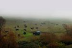
Your search returned 19310 images>
click here
for
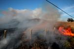
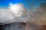
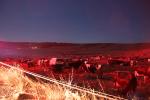
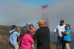
"Coast"
favorites
← Previous
Next →
1
...
51
52
53
54
55
56
57
58
59
60
61
62
63
64
65
← Previous
Next →
1
...
51
52
53
54
55
56
57
58
59
60
61
62
63
64
65
Add to Lightbox
Add to Cart
Buy Print
E-Postcard
Royalty Free
Rights Managed
Animals
Cities
Disasters
Entertainment
Food
Government
Health
Industry
Insects
Military
Nature
People
Sports
Technology
Universe
Vehicles
Animals
Cities
Disasters
Entertainment
Food
Government
Health
Industry
Insects
Military
Nature
People
Sports
Technology
Universe
Vehicles
Lightboxes
Cart
Minimize
Generic lightbox
Go to lightbox
Checkout
Terms and Conditions
Return Policy
Copyright 2008—2024 Photovault.com