Animals
Cities
Disasters
Entertainment
Food
Government
Health
Industry
Insects
Military
Nature
People
Sports
Technology
Universe
Vehicles
Explore over 500,000 Images in my personal collection
|
|
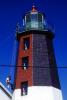
- Code Number:
- TLHV02P13_16B
- Title:
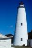
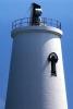
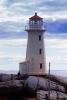
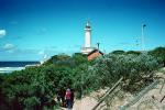
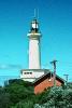
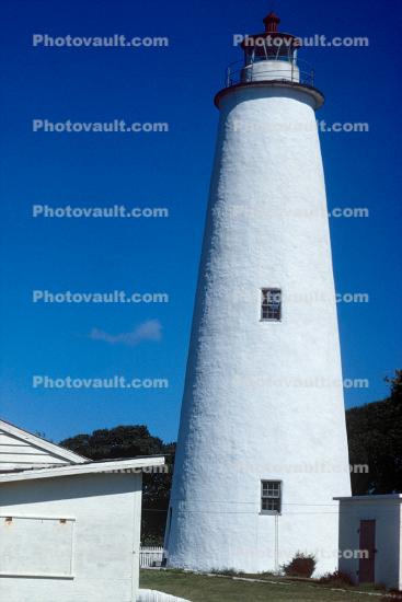
- Ocracoke Light, Hyde County, Ocracoke Island, Outer Banks, North Carolina, Eastern Seaboard, East Coast, Atlantic Ocean
- This is the oldest lighthouse still in operation in North Carolina, and one of the oldest on the Eastern coast of the United States, it was built by Noah Porter for $11,359.35 in 1823. At seventy-five feet, it is the shortest lighthouse on the North Carolina Coast and can only be seen for 14 miles. Located in Ocracoke Village on Ocracoke Island, the southernmost island in the Cape Hatteras National Seashore.
Latitude: 35.109
Longitude: -75.986
Construction started: 1798
Height: 23 m (75 feet)
Materials: Brick, Mortar, Lumber, Stone
Tower shape: Conical
Markings - pattern: White
Current lens: 4th order Fresnel lens
Range: 15 nm
Characteristic: Fixed white
Fog signal: none
Admiralty number: J2408
ARLHS number: USA-561
USCG number: 2-660
Automated: 1955
Address: Lighthouse Road, Ocracoke, NC 27960 - Keywords:
- Caption Disclaimer
Buy Print: