Explore over 500,000 Images in my personal collection
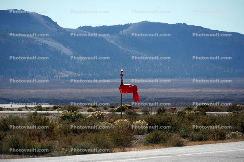
Limp Windsock at Lee Vining Airport, Mono County
Code Number:
TAAD03_278
Title:
Limp Windsock at Lee Vining Airport, Mono County
Elevation: 2,073 meters (6,802 feet)
Keywords:
Northern California, Scenics, USA, Landscape, American, Airport, Public Transportation, Civil Aviation, Infrastructure, Civilian, historical, Historic, Antique, nostalgic, vintage, Travel, Aeropuerto, Archives, Nostalgia
Image by:
Wernher Krutein

Royalty Free: Calculate Price

418 x 279 pixels This image size immediately available after purchase 2 PhotoPoints $6.00
1200 x 801 pixels This image size immediately available after purchase 3 PhotoPoints $9.00
2350 x 1569 pixels This image size immediately available after purchase 23 PhotoPoints $69.00
5400 x 3605 pixels This image size available in 3 hours after purchase 57 PhotoPoints $171.00
Ultra Hi for larger output size, please call customer service 415-720-9928
Light Beacon Tower, Porterville Municipal Airport, Tulare CountyMeadows Field Airport, Kern CountyMeadows Field Airport, Kern CountySonoma Mountain in PetalumaHangar at Lee Vining Airport, Mono CountyLimp Windsock at Lee Vining Airport, Mono CountyRunway marker at Lee Vining Airport, Mono CountyHangar at Lee Vining Airport, Mono CountyRunway at Lee Vining Airport, Mono CountyOld Hangar, Lee Vining AirportLimp Windsock, Lee Vining Airport, Highway 395Early Morning Raising of the ColorsEarly Morning Raising of the ColorsPower Line Inspectors Meeting, Kincade Fire of 2019Avgas Ford Fuel Truck
Go to lightbox