Animals
Cities
Disasters
Entertainment
Food
Government
Health
Industry
Insects
Military
Nature
People
Sports
Technology
Universe
Vehicles
Explore over 500,000 Images in my personal collection
|
|
- Code Number:
- TAAD02_249
- Title:
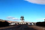
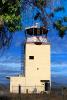
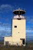
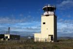
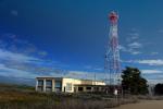
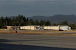
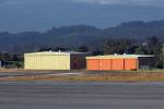
- Naval Auxiliary Field, south of Crows Landing, California Aqueduct
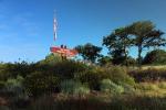
- Crows Landing Naval Auxiliary Landing Field, Central Valley Patterson, California 37.41 North / 121.11 West. Crows Landing was built in 1942 as a satellite airfield for Alameda NAS. This airbase was complemented by nearby bombing & gunnery ranges. In 1946 it was reduced to caretaker status.
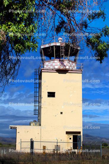
After 1965, Crow's Landing was taken over by NASA, and was used for flight tests by aircraft based at Ames Research Center & other NASA facilities in Sunnyvale California. The ends of the runways were painted to resemble carrier decks & F/A-18s from NAS Lemoore to the south would practice carrier approaches prior to going through their Carrier Qualifications. A portable set of carrier landing/approach lights were set up on either end of the main runway. The Landing Signal Officers would fly up from Lemoore in an O-2.
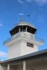
Crows Landing was closed in 1999 by NASA. At the time of its closure, the airfield consisted of two paved runways at an angle crossing to each other. (the longest, 17/35, is 7,950'). It is now mostly owned by the County Of Stanislaus. The control tower & crash building still stand, as do the field Recreation Building & pool area. NASA has some trailers with satellite antennae in occasional use on the NE side of the field. The two concrete runways are deteriorating fast and ground water clean up is continuing.
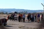
The airfield is blocked off, but local trainers still perform occasional touch & go's. - Keywords:
- Image by:
- Wernher Krutein
- Caption Disclaimer